How Satellites Detect Oil Spills in the Caspian Sea
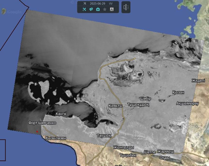
Modern satellite radar technology, called Synthetic Aperture Radar (SAR), helps detect oil spills on the sea surface. This method is especially useful in the Northern Caspian, a region that is sensitive to environmental problems caused by oil production and shipping.
How SAR Works and How Oil Affects the Water
SAR uses satellites that send microwave signals to the Earth and measure how the signals bounce back. Normally, the sea reflects these signals based on wave activity. Calm water gives a weak signal, and rough water gives a stronger one.
When oil is on the water, it smooths out the small waves. This reduces the signal that comes back to the satellite. As a result, the oil-covered area looks like a dark patch in the image. But not every dark patch is oil. Experts need to analyze the image and other conditions to be sure.
How to Tell if a Dark Patch is Oil
A dark patch may be oil if it looks smooth, has clear edges, and is stretched out in the direction of the wind. It is more likely to be oil if it appears near a ship, port, or oil platform, or if it shows up in several images over time.
However, dark patches can also be caused by other things, like natural films or temperature changes in the water. That is why experts also check the weather, especially wind speed, which is best between 3 and 8 meters per second. They also look at past images and nearby infrastructure.
